I can’t remember where I saw this one…
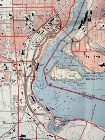
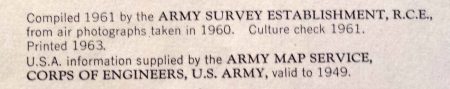
This is a map that was created in 1961 by the Army Corps of Engineers of Niagara Falls.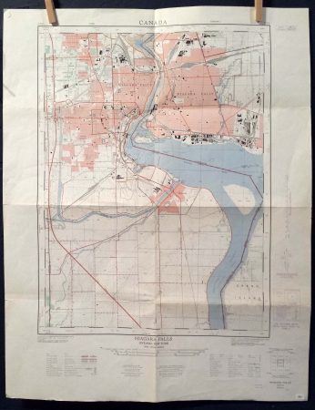
It doesn’t show any street names, but shows a lot of the hydro power water intakes, as well as a few of the important places in either city.